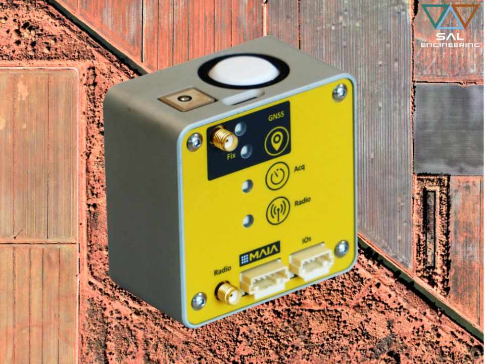
ILS - Incident Light Sensor integrated with MAIA multispectral camera measures the level of the ambient light for each shot in each band during multispectral survey. It allows the correction for downwelling light changes during the flight, such as those caused by clouds covering, and calculate the true reflectance ratios for the correct index calculations.
Furthermore, the ILS features a 6-axis inertial unit for motion processing, an environmental sensor for pressure, temperature and humidity measurement and a GNSS receiver with an embedded antenna that provides timestamp and position information for accurate geotagging of each image acquired by MAIA.
The ILS connects directly to MAIA multispectral camera and is powered and controlled by it, without any specific action required by the user for its operation, once properly mounted on board.
All parameters measured by ILS are automatically stored into the log file related to the image acquisition set, and are available for pre-processing with MultiCam Stitcher Pro, the MAIA images pre-processing software.
A high precision GNSS version with RTK is available, which allows a centimeter-level positioning accuracy. In this case, an additional ILS which acts as base station is necessary for proper operations.
· Irradiance levels of light measured with bands matched with MAIA multispectral camera;
· GNSS receiver with onboard antenna, supporting the use of an external active or passive antenna;
· 6-axis IMU and pressure, temperature, humidity sensors;
· seamless connection to MAIA multispectral camera;
· data of each measured parameter are included in the camera log file;
· single-cable connection to MAIA multispectral camera for power supply and control;
· 1s measurement rate of all parameters, synchronized with the image acquisition;
· micro SD card for additional log files storage (8 GB bundled);
· USB interface to access the SD from the host computer without removing the SD.
MAIA WV and MAIA S2 can be equipped with the Incident Light Sensor – ILS for the radiometric correction of each single shot in each single band, for the best multispectral data acquisition, in order to:
· determine precisely the fertilization by identifying the symptoms of nutritional deficiencies;
· optimize the contribution of pesticides through the early identification of biotic stress;
· optimize irrigation of crops by identifying areas of potential water stress;
· calculate agronomic indices, and set a monitoring plan in order to preview the yeld of crops;
· monitor dumps, water bodies, terrains, mines, soils and forests with a correct radiometric information, to create an effective monitoring plan of interventions.
Contact us for more information on Having Our activities, our products and services
Click here2015 - 2025 © SAL Engineering S.r.l.